Canada’s Fastest Half
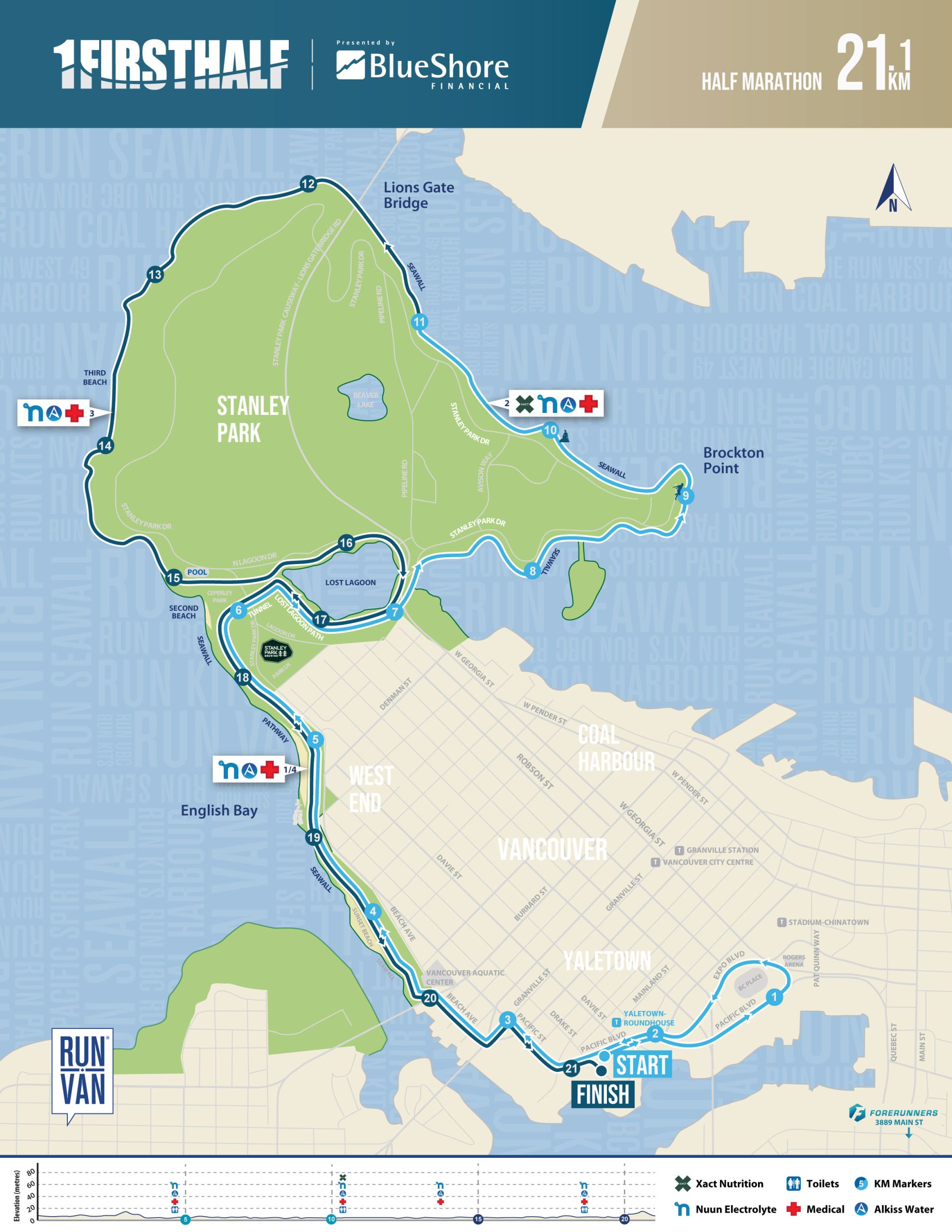
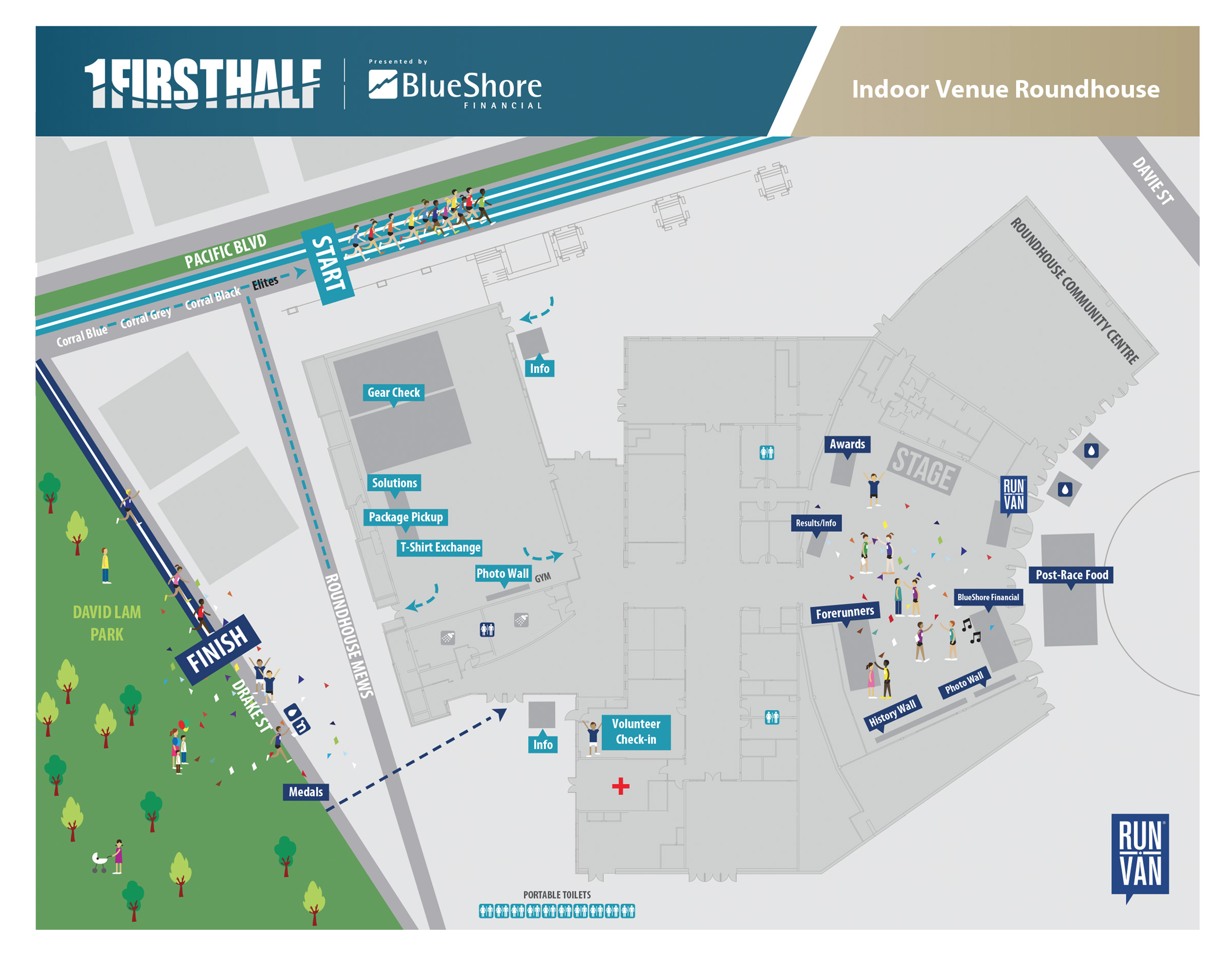
The fast First Half 21.1KM route starts and ends near Yaletown Roundhouse Community Centre. The Finish Line awaits you near Pacific Blvd and Drake St. The live course is marked at every kilometre and at halfway, and you’ll have course marshals and pacers to guide you. This route will be accurately measured and certified. For temporary road closures, please view firsthalf.ca/detours.
Optional Virtual Route Options with RunGo
21.1KM Virtual
10KM Virtual
5KM Virtual
Scenic Course
A waterfront out-and-back course, the ‘First Half’ Half Marathon is a scenic, 21.1KM route that takes place in Downtown Vancouver. Kicking off near the Roundhouse Community Centre, the First Half continues out past Sunset Beach, along the Seawall. For the virtual race, you’re asked to please find your own pedestrian friendly route.
Stations (4)
WATER Stations : Oncourse
Multiple water stations will be available oncourse for the live in-person event. Nuun Electrolyte will be at each station, plus Xact Nuitrion will be at the station near the 12.5KM mark. Each volunteer station will also include water. Stations and elevation charts are included in the maps for reference.
First Half Course Description
The First Half starts at 8:30am and finishes at 11:30am with approximately 2,500 runners expected out on the course.
The race begins in front of the Roundhouse Community Centre on Pacific Boulevard between Davie and Drake Street at 8:30am. Runners start by moving east on Pacific Boulevard and run around BC Place Stadium, up Expo Boulevard, back onto Pacific Boulevard. As the event attracts a fast field, please stay to your right and allow others to pass on your left. Runners proceed west past the Roundhouse Community Center on Pacific Boulevard, under the Granville Street Bridge, onto Beach Avenue. Continue along Beach to the Aquatic Centre, through the Aquatic Centre parking lot, to the Seawall. The race then follows the Seawall past English Bay and into Stanley Park. Runners follow the bicycle path as it descends into Ceperly Park, cross Stanley Park Dr onto the pathway, and stay racing NE on the gravel path, around Lost Lagoon, before running East in the tunnel under Stanley Park Dr. Follow the bicycle path to where the pedestrian path branches before Chilco St. Right back to the pedestrian path down hill to English Bay Beach and around the Aquatic Centre. Exit at the Aquatic Centre service road, right into Beach Ave. Runners then proceed back onto Granville Street, Pacific Street and Pacific Boulevard, to the finish on Drake Street between Pacific Boulevard and Marinaside Circle.
Most runners will be on the seawall from 9am to 10:30am.


